GIS(Geographic Information System)
On this page
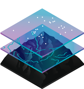
What is GIS?
A framework to organize, communicate, and understand the science of our world. GIS isn’t just for geographers, it’s for everyone.
A geographic information system (GIS) is a framework for gathering, managing, and analyzing data. Rooted in the science of geography, GIS integrates many types of data. It analyzes spatial location and organizes layers of information into visualizations using maps and 3D scenes. With this unique capability, GIS reveals deeper insights into data, such as patterns, relationships, and situations—helping users make smarter decisions.
Hundreds of thousands of organizations in virtually every field are using GIS to make maps that communicate, perform analysis, share information, and solve complex problems around the world. This is changing the way the world works.
Identify problems
How GIS Works
GIS technology applies geographic science with tools for understanding and collaboration. It helps people reach a common goal: to gain actionable intelligence from all types of data.
Maps
Maps are the geographic container for the data layers and analytics you want to work with. GIS maps are easily shared and embedded in apps, and accessible by virtually everyone, everywhere.
Geospatial analysis
Spatial analysis allows you to solve complex location-oriented problems and better understand where and what is occurring in your world. It goes beyond mere mapping to let you study the characteristics of places and the relationships between them. Spatial analysis lends new perspectives to your decision-making.
Here are some of the foundational spatial analyses and examples of how they are applied in the real world.
- Determine relationships
- Understand and describe locations and events
- Detect and quantify patterns
- Make predictions
- Find best locations and paths
Who uses GIS
Modern GIS is about participation, sharing, and collaboration. Discover how the technology is strengthening relationships, driving efficiencies, and opening communications channels in your community.
Tutorials

A hands-on guide for implementing some of the most beloved tools in the spatial python community
Resources
- A Complete Guide to Free and Offline Mapping Software: a collection of the most commonly known free mapping software, and some of the lesser-known options.
Trends
GIS Lounge is an information site covering research and case studies about the applications of geographic information systems, geospatial technologies, and cartography. The purpose of this site is to provide introductory text for issues relating to GIS as well as interesting news items, tips, and resources for the geospatial field.
Geography Realm is an information site about all things geography. Find information here about physical and human geography as well as guides for learning about geography and developing a career in geography.
Geospatial PR is a site that publishes press releases from GIS and geospatial companies.
An interactive and engaged community of geospatial professionals, teaching and learning from one another.
Thought-provoking stories on location intelligence and critical technology trends
The MapScaping Podcast is a weekly podcast featuring interesting people doing amazing work in the geospatial world. During each podcast, they interview experts and feature people that will help you learn more about GIS, geospatial, remote sensing and earth observation.
Tools
Contains several gis related commands tools.
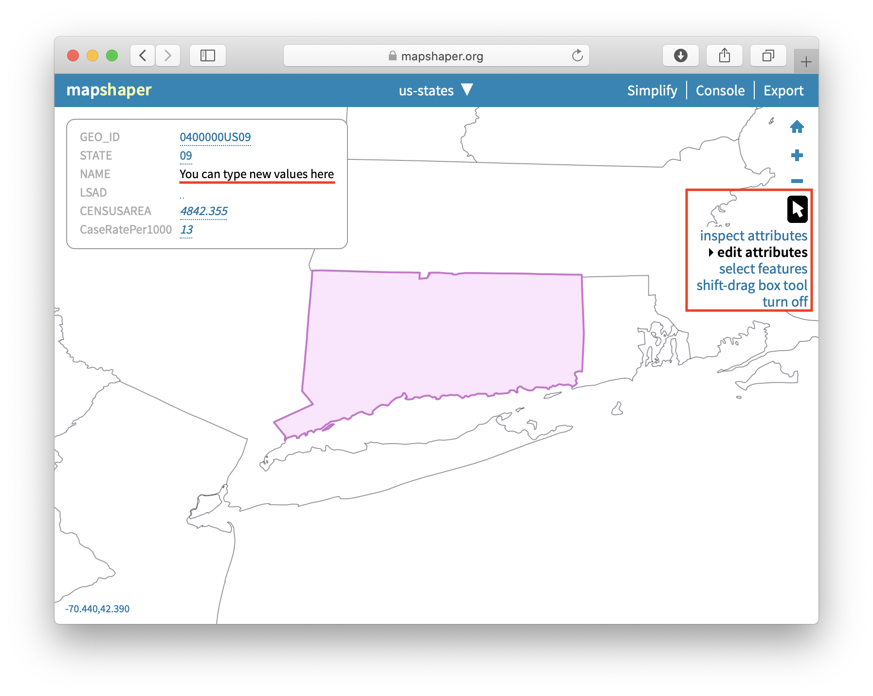
Mapshaper is software for editing Shapefile, GeoJSON, TopoJSON, CSV and several other data formats, written in JavaScript.
Mapshaper supports essential map making tasks like simplifying shapes, editing attribute data, clipping, erasing, dissolving, filtering and more.
Mapshaper includes several command line programs, which can be run under Mac OS X, Linux and Windows.
mapshaperRuns mapshaper commands.mapshaper-xlWorks the same as mapshaper, but runs with more RAM to support larger files.mapshaper-guiRuns the mapshaper Web interface locally.
var singleobject = { name: 'Location A', category: 'Store', street: 'Market', lat: 39.984, lng: -75.343, alt: 1024.76 }GeoJSON.parse(singleobject, {Point: ['lat', 'lng', 'alt']});{"type": "Feature","geometry": {"type": "Point", "coordinates": [-75.343, 39.984, 1024.76]},"properties": {"name": "Location A","category": "Store"}}
Turn your geo data into GeoJSON.
Calculate the area inside of any GeoJSON geometry.
var geojsonArea = require("@mapbox/geojson-area");var area = geojsonArea.geometry(obj);
Data

OpenTopography is a portal that provides access to open sources of topographical datasets and processing tools.